You are using an out of date browser. It may not display this or other websites correctly.
You should upgrade or use an alternative browser.
You should upgrade or use an alternative browser.
Hong kong which inspired me!
- Thread starter pdsubbu
- Start date
More options
Who Replied?Where is the guan yin temple?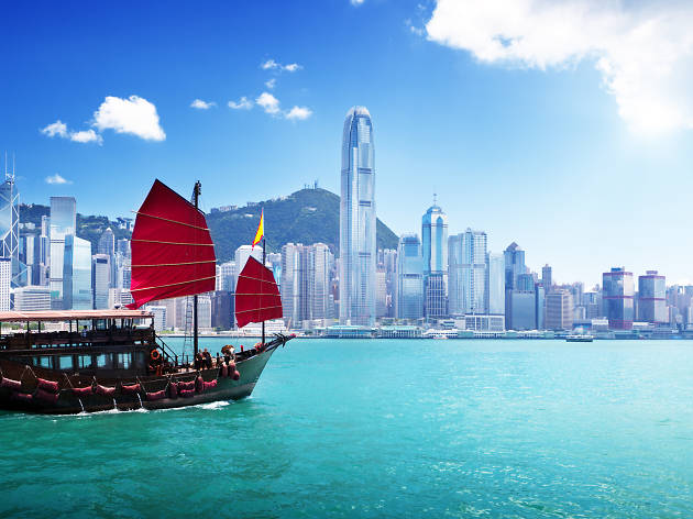


Do upload more inspiring pics, should anyone have any?

rrr2015
Arch-Supremacy Member
- Joined
- Nov 29, 2015
- Messages
- 13,350
- Reaction score
- 4,877
nice shot! have you been to needle hill?
where to get transportation info for all these HK trails?
where to get transportation info for all these HK trails?

Wild Hong Kong!
s7460597
Arch-Supremacy Member
- Joined
- May 31, 2002
- Messages
- 15,954
- Reaction score
- 752
nice shot! have you been to needle hill?
where to get transportation info for all these HK trails?
Hope this helps.
https://thehoneycombers.com/hong-kong/hiking-in-hong-kong-nature-scenery-fitness/
rrr2015
Arch-Supremacy Member
- Joined
- Nov 29, 2015
- Messages
- 13,350
- Reaction score
- 4,877
thanks ... this gives a good summary of some trails
nice shot! have you been to needle hill?
where to get transportation info for all these HK trails?
never been to needle hill. in hk, public transportation has comprehensive coverage.
btw, this was sharp's peak at saikung.
rrr2015
Arch-Supremacy Member
- Joined
- Nov 29, 2015
- Messages
- 13,350
- Reaction score
- 4,877
ok thanks ... will look around for more info. just noticed quite a lot bloggers already covers their hike
never been to needle hill. in hk, public transportation has comprehensive coverage.
btw, this was sharp's peak at saikung.
ok thanks ... will look around for more info. just noticed quite a lot bloggers already covers their hike
quite close to tai mo shan and shing mun reservoir. transportation should be very easy.
rrr2015
Arch-Supremacy Member
- Joined
- Nov 29, 2015
- Messages
- 13,350
- Reaction score
- 4,877
ok thanks ... how's mobile network coverage in HK trails?
quite close to tai mo shan and shing mun reservoir. transportation should be very easy.
tiger2013
High Supremacy Member
- Joined
- Jul 25, 2013
- Messages
- 32,301
- Reaction score
- 1,506
ok thanks ... how's mobile network coverage in HK trails?
Trails in general got signals. Just don't go inside the jungle (if it's nearby). I don't know if got signals inside because I never tried that, and I don't wish to get lost in a foreign country and becoming headline news there (+ perhaps Singapore as well).
If you are worried, join HK hiking groups to go for hikes.
ok thanks ... how's mobile network coverage in HK trails?
depends on the location. some places got no signal from hk but chinese
")
trails in hk are well marked. for more popular trails, there are even emergency phone booths at regular intervals.
for tai mo shan, for being the highest peak and in the center of hk, there is a weather station on top with some telecommunication towers.
Last edited:
rrr2015
Arch-Supremacy Member
- Joined
- Nov 29, 2015
- Messages
- 13,350
- Reaction score
- 4,877
thanks all! will explore more options probably start with easier ones first
not that adventurous, will certainly stay on the track
if got weather station means there will be road up to the peak
not that adventurous, will certainly stay on the track
Trails in general got signals. Just don't go inside the jungle (if it's nearby). I don't know if got signals inside because I never tried that, and I don't wish to get lost in a foreign country and becoming headline news there (+ perhaps Singapore as well).
If you are worried, join HK hiking groups to go for hikes.
if got weather station means there will be road up to the peak
depends on the location. some places got no signal from hk but chinese
trails in hk are well marked. for more popular trails, there are even emergency phone booths at regular intervals.
for tai mo shan, for being the highest peak and in the center of hk, there is a weather station on top with some telecommunication towers.
s7460597
Arch-Supremacy Member
- Joined
- May 31, 2002
- Messages
- 15,954
- Reaction score
- 752
thanks all! will explore more options probably start with easier ones first
not that adventurous, will certainly stay on the track
if got weather station means there will be road up to the peak
Please keep a close eye on weather updates. Take proper precautions, food water, dressing to keep warm or cool Depending on season etc. In the open wind chill can beat big factor.
Yes, search in Google and you can find guides to walking around the peak.
rrr2015
Arch-Supremacy Member
- Joined
- Nov 29, 2015
- Messages
- 13,350
- Reaction score
- 4,877
Thanks points noted ... will read thru various guides to select suitable trails for myself
Please keep a close eye on weather updates. Take proper precautions, food water, dressing to keep warm or cool Depending on season etc. In the open wind chill can beat big factor.
Yes, search in Google and you can find guides to walking around the peak.
Last edited:
evilerniex
Arch-Supremacy Member
- Joined
- Mar 11, 2006
- Messages
- 17,525
- Reaction score
- 23
Anyone done Tai Mo shan? How difficult is it, compared to dragon back trail?
Thinking of going, but dunno if can take it or not

Important Forum Advisory Note
This forum is moderated by volunteer moderators who will react only to members' feedback on posts. Moderators are not employees or representatives of HWZ. Forum members and moderators are responsible for their own posts.
Please refer to our Community Guidelines and Standards, Terms of Service and Member T&Cs for more information.
Please refer to our Community Guidelines and Standards, Terms of Service and Member T&Cs for more information.