
TouringSG
Senior Member
- Joined
- Dec 27, 2014
- Messages
- 643
- Reaction score
- 198
Does anyone know how does the Govt decide which areas are to be CCR, RCR and OCR? I tried searching on URA, but it doesn't have any concrete definition/criteria: https://spring.ura.gov.sg/lad/ore/login/glossary.cfm?no=1
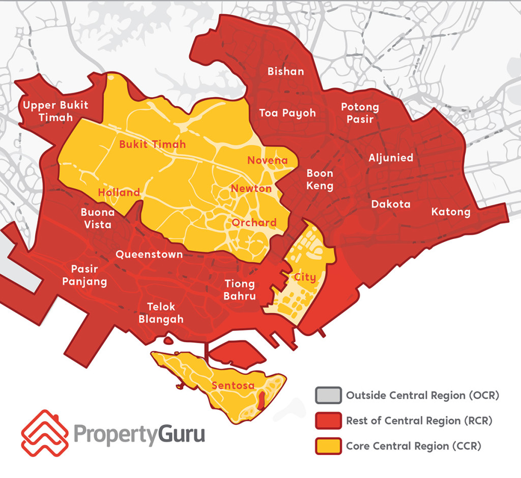
Looking at the map below, it is clear that the CCR/RCR is not broken down geographically as CCR is broken up into pieces with RCR cutting in-between. Neither is it determined by development maturity in the early days, whether it's CBD or how high the PSF of the area is, as Tiong Bahru and the gap between Orchard and City are not included.
The area size of RCR is also not consistent on the left and right of CCR too, with RCR in the East spreading way further away from CCR, whereas the RCR in the west is almost non-existent.
Any ideas?
Last edited:
 Everyone else is “the rest of”